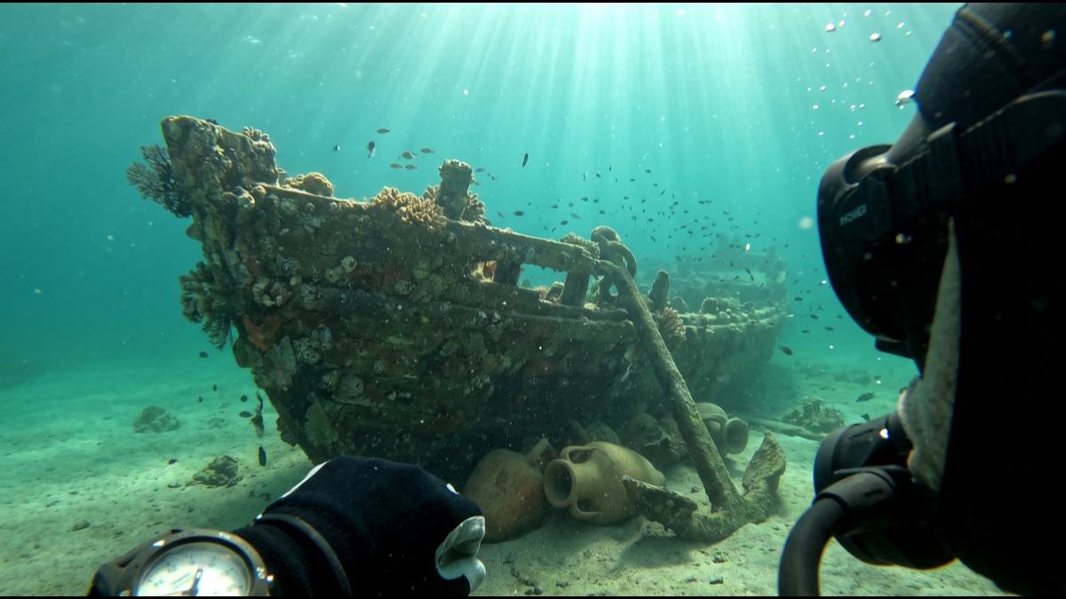
Fewer than a handful of the world's most famous shipwreck discoveries began with a treasure map. Most began instead with a trawler's net snagging on something unexpected, a fisherman noting an odd depth reading in a spot he had crossed a thousand times before, or a research vessel towing a sonar array across a seabed for an entirely unrelated survey and stumbling onto a wreck no one was looking for.
The romantic image of a lone explorer following an old chart to a hidden hoard belongs almost entirely to fiction. Real shipwreck discovery is a slower, more technical, and far more accidental business, built from a combination of oceanographic survey technology, painstaking archival research, and genuine chance, and understanding that mix explains why some of history's most significant wrecks sat undiscovered for centuries within a few kilometers of busy shipping lanes.
Why Most Shipwrecks Are Found by Accident
The ocean floor is vast, largely dark, and expensive to survey in the kind of detail needed to spot a wreck rather than simply a rock or a natural ridge, which means that dedicated shipwreck searches are relatively rare and usually reserved for a small number of historically significant, well-documented losses with a strong likelihood of funding and public interest.
The overwhelming majority of the many thousands of wrecks recorded worldwide were instead found incidentally, during unrelated activity such as commercial fishing, offshore construction surveys, oil and gas exploration, cable-laying operations, or military and scientific seabed mapping conducted for a completely different purpose than wreck hunting.
This accidental pattern means the distribution of known wrecks is heavily skewed toward busy, well-surveyed coastal waters and shipping corridors, while enormous stretches of deeper, less economically active ocean remain essentially unexamined, hiding an unknown but likely very large number of wrecks that simply have never been near anyone conducting any kind of seabed survey.
How Fishermen Have Historically Been the First Discoverers
Commercial fishing crews, particularly those working bottom trawls that drag nets close to the seabed, have been responsible for an outsized share of wreck discoveries simply because they cover enormous areas of seafloor repeatedly over years of routine work, developing an intimate practical knowledge of exactly where their nets snag on something that is clearly not a natural rock formation.
A snagged or torn net at a specific, repeatable location is one of the oldest and most reliable informal signals of a wreck site, and maritime archaeologists have long maintained working relationships with local fishing communities specifically to collect these tips, since a fisherman who has lost gear at the same coordinates several times has effectively conducted an unintentional but highly localized survey.
Sonar imaging brought to some fishing vessels for entirely commercial reasons, to locate fish stocks rather than wrecks, has incidentally produced a substantial number of additional finds, as crews reviewing their own equipment's seabed imagery occasionally notice a distinctly artificial shape among the natural terrain.
How Sonar and Sub-Bottom Profilers Actually Map the Seabed
Side-scan sonar, the workhorse tool of deliberate wreck surveys, works by towing a sensor behind a survey vessel that emits sound pulses to either side and records the pattern of their return, building a photograph-like image of the seabed's surface shape from which an experienced analyst can distinguish an artificial hull outline from natural rock or reef.
Sub-bottom profilers extend this capability by using lower-frequency sound that penetrates some distance into the sediment itself rather than only imaging the surface, which is essential for locating wrecks that have been substantially or completely buried by centuries of sediment accumulation and would be entirely invisible to standard side-scan sonar alone.
Multibeam sonar, a more recent refinement, sweeps a fan of beams simultaneously rather than a single narrow pulse, producing detailed three-dimensional seabed maps far more efficiently than older single-beam methods, and has become the standard tool for the systematic seabed mapping projects that occasionally turn up wrecks as an incidental byproduct.
What Magnetometers Detect That Sonar Cannot
A magnetometer detects local distortions in the earth's magnetic field caused by ferrous metal, making it particularly valuable for locating wrecks whose wooden hull has completely decayed but which carried iron anchors, cannon, chain, or cargo, none of which would produce any distinctive sonar return once the surrounding wood structure is gone.
This makes magnetometer survey especially important for very old wrecks, since a wooden ship lost centuries ago in warmer, shallower, or more biologically active waters may have almost no surviving hull structure at all, leaving scattered iron fittings as essentially the only detectable physical trace remaining on the seabed.
Survey teams frequently run magnetometer and sonar passes together over the same search grid, since the two instruments are sensitive to different physical properties and a site producing a signal on only one of them still merits a closer look with the other before being ruled out.
How Historical Records Narrow a Search Area
Before any physical survey begins, a well-resourced wreck search typically starts with archival research into ship's logs, insurance claims, court records from subsequent litigation, newspaper accounts, and the navigational records of vessels that later passed through or near the presumed loss location, all cross-referenced to reconstruct the most probable search area.
Even excellent historical records rarely pin down a sinking location with modern GPS-level precision, since navigation methods of earlier centuries carried substantial inherent error, and a search area derived purely from archival research can still span many square kilometers of seabed even after careful cross-referencing of multiple independent sources.
Weather records, known current patterns for the relevant season, and the physics of how a damaged vessel would likely have drifted before finally sinking are all incorporated into refining that search area further, since a ship rarely sank at the exact coordinates where the initial damage occurred.
Why Ocean Currents and Sediment Complicate a Search
A wreck's final resting position is frequently some distance from where the initiating incident actually happened, since a damaged vessel can drift for hours or even days before finally sinking, and its wreckage can subsequently be dispersed further across the seabed by currents acting on the site over the following centuries.
Sediment accumulation rates vary enormously by location, and a wreck resting in an area with high sediment deposition can become substantially or completely buried within a relatively short historical timeframe, while a wreck on a rocky, low-sediment seabed may remain comparatively exposed and more readily detectable by sonar alone even centuries later.
Storm events can also periodically re-expose a previously buried wreck by scouring away accumulated sediment, which is one reason some wrecks are discovered, lost to view again as sediment returns, and then rediscovered independently by a later survey unaware of the earlier find.
How Remotely Operated Vehicles Confirm a Find
A promising sonar or magnetometer target still requires direct visual confirmation before it can be reliably classified as a genuine shipwreck, since natural rock formations, geological features, and modern debris can all produce ambiguous readings that superficially resemble a wreck signature on remote sensing equipment alone.
Remotely operated vehicles, tethered submersible robots equipped with cameras, lights, and often manipulator arms, are the standard tool for this confirmation stage, allowing a survey team to inspect a target closely and safely at depths well beyond the practical or legal limits of human diving without risking a crew member's life on what may turn out to be a natural formation.
For wrecks in genuinely extreme depths, well beyond several thousand meters, only a small number of specialized deep-submergence vehicles worldwide are capable of reaching and documenting the site at all, which is part of why a handful of the most famous deep-ocean wrecks took so many decades to locate even once their approximate location was reasonably well established from records.
Why Depth Determines Which Tools Are Even Possible
Human diver access is generally limited to well under a hundred meters even with specialized technical diving equipment, meaning the substantial majority of the ocean's depth range, which averages well over three thousand meters, is entirely inaccessible to any form of direct human underwater investigation and depends entirely on remote instrumentation.
Equipment cost and complexity rise sharply with depth capability, since deeper-rated vehicles require pressure-resistant housings, more sophisticated tethering or autonomous power systems, and considerably more expensive support vessels, which is a major reason why deep-ocean wreck surveys remain comparatively rare and typically require substantial institutional or private funding.
This depth constraint is also why shallow coastal waters, despite being far more heavily fished, dived, and developed, still continue to yield new wreck discoveries regularly, while vast stretches of deep ocean floor that likely also hold significant wrecks remain almost entirely unexamined for reasons of pure practical accessibility.
How a Wreck Gets Legally and Archaeologically Claimed
The legal status of a newly discovered wreck depends heavily on its location, age, and the nationality of the original vessel, with wrecks in a country's territorial waters generally falling under that country's heritage protection law, while wrecks in international waters can involve a considerably more complex mix of maritime salvage law, the vessel's flag state, and international heritage conventions.
Several international agreements now specifically protect wrecks over a certain age threshold from unregulated salvage, reflecting a broader shift in professional practice away from treating old wrecks purely as recoverable property and toward treating culturally or historically significant wrecks as protected archaeological sites deserving systematic study rather than extraction.
A discoverer does not automatically gain ownership or exclusive salvage rights simply by finding a wreck first, and disputes over who holds legitimate rights to excavate or recover material from a significant find have produced extended and sometimes bitter legal proceedings in multiple well-known cases.
Why Some Wrecks Are Deliberately Left Undisturbed
Many wrecks, once located and confirmed, are deliberately left in place rather than excavated, reflecting a professional archaeological consensus that a wreck undisturbed on the seabed is frequently better preserved and more informative to future researchers equipped with better technology than one hastily recovered with the tools available today.
Wrecks that also serve as a war grave, containing the remains of crew who died aboard, are commonly granted additional legal and ethical protection specifically preventing disturbance, treating the site as a memorial rather than simply an archaeological resource or a source of recoverable artifacts.
Some wrecks are also left in place simply because full excavation is prohibitively expensive relative to the funding available, and the responsible choice under those funding constraints is frequently judged to be careful, non-invasive documentation rather than a rushed and inadequately resourced recovery effort.
How Treasure-Hunting Differs From Archaeological Excavation
Commercial treasure-hunting operations are generally oriented toward recovering financially valuable cargo as efficiently as possible, an approach that professional maritime archaeologists frequently criticize for prioritizing speed and salable recovery over the careful, methodical documentation of a site's overall context that archaeological method demands.
Archaeological excavation instead treats the position, orientation, and precise context of every recovered item as data in its own right, since the relationship between objects on a wreck can reveal information about cargo loading practices, crew life, and the specific sequence of the ship's final moments that isolated recovered objects alone cannot convey.
This tension has produced ongoing professional and legal disputes in multiple jurisdictions over whether commercial salvage operators should be granted access to historically significant wrecks at all, with many countries now imposing stricter licensing requirements specifically distinguishing legitimate archaeological work from purely commercial recovery.
What a Wreck Site Can Actually Teach Historians
A well-preserved wreck functions as an unusually complete time capsule, since it typically sank rapidly and was then sealed from significant further human disturbance, preserving a coherent cross-section of everyday cargo, personal possessions, and shipboard equipment that land-based archaeological sites, subject to centuries of subsequent disturbance and reuse, rarely preserve as completely.
Cargo manifests recovered from wrecks have repeatedly revised historians' understanding of the actual scale and composition of historical trade routes, since surviving written trade records are frequently incomplete or biased toward officially taxed and recorded goods, while a wreck's physical cargo reveals what was genuinely being transported regardless of what was formally documented.
Shipbuilding technique, visible directly in a wreck's surviving hull structure, has also substantially revised historical understanding of naval engineering capability in specific periods, since written descriptions of historical shipbuilding are frequently far less precise than the physical evidence a well-preserved hull can provide directly.
Why Most of the Ocean Floor Remains Unmapped
Despite substantial recent progress in global seabed mapping initiatives, a large majority of the ocean floor remains mapped only at coarse resolution derived from satellite altimetry rather than the high-resolution sonar detail actually required to reliably identify something as specific as a shipwreck against natural seabed terrain.
International efforts aiming for complete high-resolution seabed mapping by the end of this decade represent a substantial acceleration of previous survey pace, but even under an optimistic completion timeline, systematically searching that newly mapped terrain specifically for wrecks would represent a separate, additional undertaking well beyond the base mapping project itself.
Given this vast remaining gap, most experts in the field consider it essentially certain that a substantial number of historically significant wrecks, some connected to well-documented but never-located historical losses, remain entirely undiscovered simply because no survey of sufficient resolution has yet passed over their actual resting place.
Sources
- Wikipedia — overview of marine archaeology methods and notable shipwreck discoveries
- UNESCO — Convention on the Protection of the Underwater Cultural Heritage
- NOAA Ocean Exploration — seabed mapping and shipwreck survey technology and expeditions
- GEBCO Seabed 2030 — global initiative to map the entire ocean floor
- ICOMOS — international standards on underwater cultural heritage protection
FAQ
Are most shipwrecks found using treasure maps?
No — the large majority are found incidentally, through fishing, offshore construction, cable-laying, or seabed mapping surveys conducted for entirely unrelated purposes.
Can divers reach most shipwrecks directly?
No — the vast majority of the ocean's depth range is well beyond safe human diving limits, so remotely operated vehicles and submersibles do most deep-water investigation.
Does finding a wreck first give you the right to keep what's on it?
Not automatically — legal rights depend on location, age, and applicable heritage law, and many significant wrecks are protected from unregulated salvage entirely.
Why are some confirmed wrecks never excavated?
Archaeologists often judge an undisturbed wreck to be better preserved for future study, and some sites are protected as war graves or are too costly to excavate responsibly.
How much of the ocean floor has been mapped in detail?
Only a fraction has been mapped at the resolution needed to reliably spot a wreck, though international initiatives are working toward complete high-resolution seabed mapping.
About the Author
We reference Wikipedia, UNESCO, NOAA Ocean Exploration, the GEBCO Seabed 2030 project, and ICOMOS to explain the background and current understanding of this topic.
Loved This Article?
Share it on WhatsApp → Share it on WhatsApp
Get more guides in your inbox — Subscribe to our newsletter for weekly surprising stories from Egypt, Saudi Arabia, Dubai, and beyond.